
Current Statistics of 25 Districts in 9 Provinces of Sri Lanka.
Note that although the Northern Province has Five Administrative Districts, it has only two Electorial Districts. Therefore there are only 22 Electorial Districts in Sri Lanka.
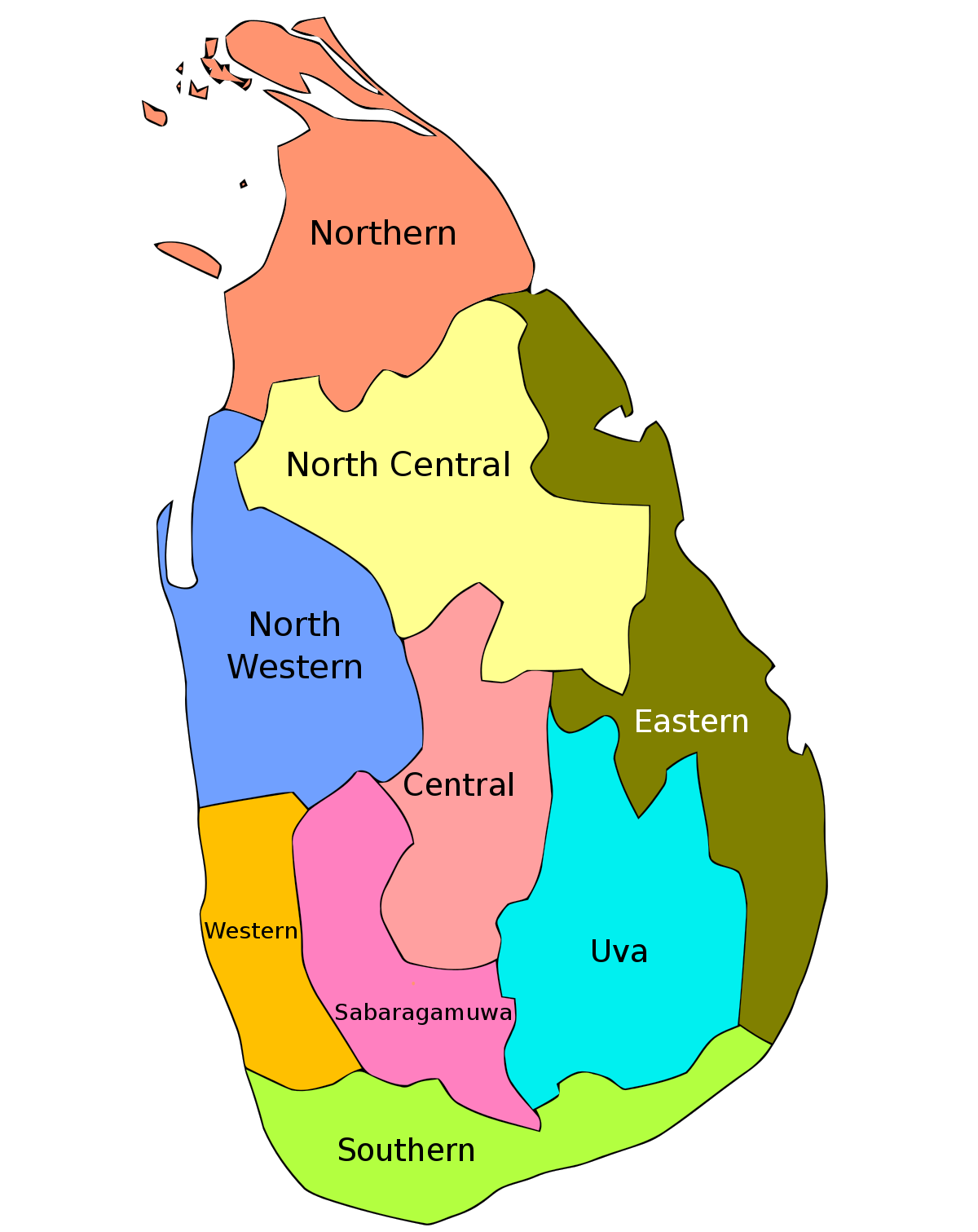
In 1833 a legislative council was created, making the island a politically and administratively single unit. Five provinces were created, later expanded into nine, and these were subdivided into twenty-one districts. These districts were administered by officials known as Government Agents or Assistant Government Agents.
In 1955, the district replaced the province as the country's main administrative unit. Ampara District was created in April 1961, followed by the creation of Mullaitivu and Gampaha districts in September 1978 through a new constitution, which also reintroduced the province as the main administrative unit. The last district to be created was Kilinochchi in February 1984, and the current constitution (that of 1978) states that the territory of Sri Lanka consists of 25 administrative districts. These districts may be subdivided or amalgamated by a resolution of the Parliament of Sri Lanka.
Since 1987 the 25 districts are purely administrative under the 9 Provincial Councils created in by the 13th Amendment to the Sri Lanka constitution.
Jaffna and Kilinochchi form the Jaffna Electorial District.
Mannar, Vavuniya, and Mullaitivu form the Vanni Electorial District.
The Ampara District is known as the Digamadulla Electorial District.
| rovince | Capitol | Created | Area km2 | Population | Districts 1955 1985 | Popula. Density | |
| Northern | Jaffna | 1833 | 8,290 | 1,058,762 | 3 | 5 | 128 |
| North Western | Kurunegala | 1845 | 7,506 | 2,370,075 | 2 | 2 | 316 |
| Western | Colombo | 1833 | 3,593 | 5,821,710 | 2 | 3 | 1,620 |
| North Central | Anuradhapura | 1873 | 9,741 | 1,259,567 | 2 | 2 | 129 |
| Central | Kandy | 1833 | 5,575 | 2,558,716 | 3 | 3 | |
| Sabaragamuwa | Ratnapura | 1889 | 4,921 | 1,918,880 | 2 | 2 | 390 |
| Eastern | Trincomalee | 1833 | 9,361 | 1,551,381 | 2 | 3 | 166 |
| Uva | Badulla | 1886 | 8,335 | 1,259,900 | 2 | 2 | 151 |
| Southern | Galle | 1833 | 5,383 | 2,464,732 | 3 | 3 | 458 |
| Total | 62,705 | 20,263,723 | 21 | 25 | 323 | ||
District Map of Sri Lanka


Comments
Post a Comment