
 |
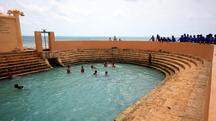
| POINT PEDRO |
The Northern Province is one of the nine provinces of Sri Lanka, the first level administrative division of the country. The provinces have existed since the 19th century but did not have any legal status until 1987 when the 13th Amendment to the Constitution of Sri Lanka established provincial councils. Between 1988 and 2006 the province was temporarily merged with the Eastern Province to form the North Eastern Province. The capital of the province is Jaffna. The majority of the Sri Lankan Civil War was played out in this province.
HISTORY

Parts of present-day Northern Province were part of the pre-colonial Jaffna kingdom. Other parts were ruled by Vanniar Chieftains who paid tribute to the Jaffna kingdom. The province then came under Portuguese, Dutch and British control. In 1815 the British gained control of the entire island of Ceylon. They divided the island into three ethnic based administrative structures: Low Country Sinhalese, Kandyan Sinhalese and Tamil. The Northern Province was part of the Tamil administration. In 1833, in accordance with the recommendations of the Colebrooke-Cameron Commission, the ethnic based administrative structures were unified into a single administration divided into five geographic provinces. The districts of Jaffna, Mannar, Nuvarakalaviya (present day Anuradhapura District) and Vanni formed the new Northern Province. Nuvarakalaviya was transferred to the newly created North Central Province in 1873.
The Indo-Lanka Accord signed on 29 July 1987 required the Sri Lankan government to devolve powers to the provinces and, in the interim, to merge the Northern and Eastern provinces into one administrative unit. The accord required a referendum to be held by 31 December 1988 in the Eastern Province to decide whether the merger should be permanent. Crucially, the accord allowed the Sri Lankan president to postpone the referendum at his discretion.

On 14 November 1987 the Sri Lankan Parliament passed the 13th Amendment to the 1978 Constitution of Sri Lanka and the Provincial Councils Act No 42 of 1987, establishing provincial councils. On September 2 and 8 1988 President Jayewardene issued proclamations enabling the Northern and Eastern provinces to be one administrative unit administered by one elected Council. The North-East Province was born.
The proclamations were only meant to be a temporary measure until a referendum was held in the Eastern Province on a permanent merger between the two provinces. However, the referendum was never held and successive Sri Lankan presidents issued proclamations annually extending the life of the "temporary" entity.
The merger was bitterly opposed by Sri Lankan nationalists. The combined North-East Province occupied one fourth of Sri Lanka. The thought of the rebel Liberation Tigers of Tamil Eelam controlling this province, directly or indirectly, alarmed them greatly. On 14 July 2006, after a long campaign against the merger, the Janatha Vimukthi Peramuna political party filed three separate petitions with the Supreme Court requesting a separate provincial council for the East. On 16 October 2006 the Supreme Court ruled that the proclamations issued by President Jayewardene were null and void and had no legal effect. The North-East Province was formally de-merged into the Northern and Eastern provinces on 1 January 2007.

Much of the Northern Province was under the control of rebel Liberation Tigers of Tamil Eelam for many years during the civil war. The entire province was recaptured by the Sri Lankan military in 2009.
While the Northern province has seen an era of peace after the end of the war the scars left by the war still remain.Despite the large amount of infrastructure projects undertaken by the Rajapaksa government at the cost of over $3 Billion the projects have been unable to create new jobs and as a result the province is suffering from extreme levels on unemployment..
In late 2014, former President of Sri Lanka Mahinda Rajapaksa imposed a travel ban to prevent foreigners from traveling to the former war zone in the province. This ban was lifted three months later by the newly elected president Maithripala Sirisena.
GEOGRAPHY

Northern Province is located in the north of Sri Lanka and is just 22 miles (35 km) from India. It is connected with Indian mainland by Adam's Bridge (also known as Sethu Paalam or Rama's Bridge). It has an area of 8,884 square kilometres (3,430 sq mi).
The province is surrounded by the Gulf of Mannar and Palk Bay to the west, Palk Strait to the north west, the Bay of Bengal to the north and east and the Eastern, North Central and North Western provinces to the south.
The province is divided into two distinct geographic areas: Jaffna peninsula and the Vanni. Jaffna peninsula is irrigated by underground aquifers fed by wells whereas the Vanni has irrigation tanks fed by perennial rivers. Major rivers include: Akkarayan Aru, Aruvi Aru, Kanakarayan Aru, Kodalikkallu Aru, Mandekal Aru, Nay Aru, Netheli Aru, Pali Aru, Pallavarayankaddu Aru, Parangi Aru, Per Aru, Piramenthal Aru, Theravil Aru.
The province has a number of lagoons, the largest being Jaffna Lagoon, Nanthi Kadal, Chundikkulam Lagoon, Vadamarachchi Lagoon, Uppu Aru Lagoon, Kokkilai lagoon, Nai Aru Lagoon and Chalai Lagoon.
Most of the islands around Sri Lanka are to be found to the west of the Northern Province. The largest islands are: Velanaitivu (Kayts), Neduntivu (Delft),Karaitivu , Pungudutivu
and Mandativu.Northern Province is covered in tropical forests, with numerous rivers flowing through them. The north-west coast is part of the deep Cauvery (Kaveri) River Basin of south-east India, which has been collecting sediments from the highlands of India and Sri Lanka since the breakup of Gondwanaland.
 |
| Dambakola Patuna |
CLIMATE AND WEATHER
Sri Lanka enjoys a typical tropical monsoonal climate. The Northern Province tends to be hot and dry in the dry season (February to September), and moderately cool and wet in the wet season (October to January). The province's climate is of the tropical kind and therefore during monsoons there is always the chance of a deluge. In the lowlands the climate is typically tropical with the average temperature is around 28° to 30° for the year. However, on the whole, January is the coolest month and May is the hottest month. Relative Humidity varies from 70% during the day to 90% at night. The Dry Zone of the Sri Lanka is the north and east of the island, this region is affected by the north east monsoon(December to March) and southwest monsoon (June to October). It is thought to be dry because most of the rains fall during the north-east monsoon.
Annual rainfall is less than 1250 mm in the north west and south east of the Inland. It has two rainy seasons South West Monsoon- May to August, North East Monsoon- November to February.
Major cities and towns
| City/town | District | Population (2012 est)[20] |
|---|---|---|
| Vavuniya | Vavuniya | 99,653 |
| Jaffna | Jaffna | 88,138 |
| Chavakacheri | Jaffna | 41,407 |
| Mannar | Mannar | 35,817 |
| Point Pedro | Jaffna | 31,351 |
| Valvettithurai | Jaffna | 27,210 |
ECONOMY
 |
| Farm land in Kandarodai |
The majority of the people earn their livelihood as farmers, fishers, and professionals in the civil and business sectors. Before the civil war cement and chemical industries along with fishing made a major contribution to the economy. However now they have been abandoned and the factories are rusting. Close to a third of the population is unemployed far more than Sri Lanka and work is mostly informal and thus unstable. The population that managed to flee to foreign nations provide a steady flow of foreign remittances to their relatives in the province. However, with the election victory of President Maithripala Sirisena and the removal of restrictions that prevented foreigners from visiting the north contributed to the sense of economic renewal alongside the development of Kankesanthurai Harbor the Palali Airport. Hospitals and schools as well as a cultural center and vocational training facility is being built in Jaffna. Investments have also started to flow into an industries such chemical and cement factories, hotels, apparel factories, power plants and aquaculture farms. As of 2018 the apparel industry of the province employ 7,917 staff and represent an investment of US$65 million with factories in Vavuniya, Killinochchi, Mannar and Mullaitivu.
The Northern Province's contribution the Gross Domestic Product is the lowest among the nine provinces representing only 3.5% of the overall GDP in 2015 however the Provincial Gross Domestic Product(PGDP) Nominal Growth Rate was 12.1% in 2015 and is the fastest growing province alongside the North Central Province.
Northern Province being an agricultural dominant province, where agricultural sector is 25.9% and trade sector comes next to it is 19.3%. Most of the people engaged in service sector covering 31.2% of the total.
PLACES TO VISIT IN JAFFNA
- Nallur
Kandaswamy Kovil
- Jaffna
Port
- Jaffna
Library
- Nilavarai
Bottomless well
- Fort Hammenheil
- Jaffna Archaeological Museum
- Delft Island
[Northern Province. Text and Images
by Google, copyright(s) reserved by original authors.]
 |
Naga DeepayaUNMISSABLE PLACES IN JAFFNA |


Comments
Post a Comment